 |
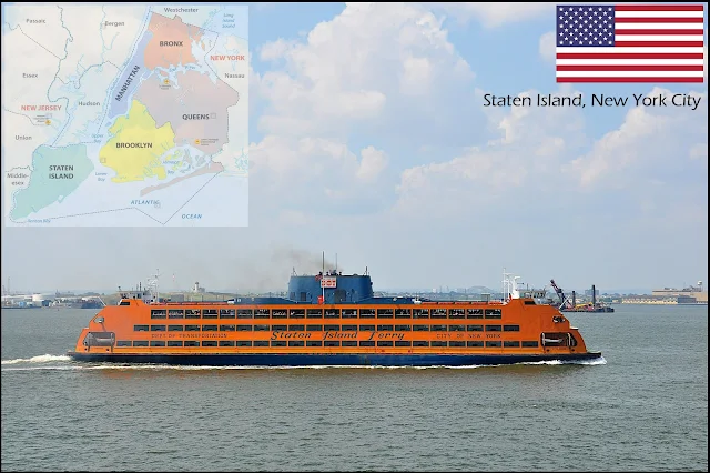
| Staten Island Ferry, New York City (Image by sdmx from Pixabay) |
Staten Island, New York City
This is one of New York’s five boroughs (the others being Manhattan, Brooklyn, Queens and The Bronx). It is the most geographically isolated and the least densely populated of the five. Until the 1970s Staten Island was known as the Borough of Richmond, reflecting its proximity to Richmond County, the most southerly in New York State. It is the third largest borough at 153 sq km.
The island’s
modern history goes back to the arrival of European settlers. Dutch attempts to
settle the place in the early 17th century foundered in the face of
stiff opposition from the indigenous tribes, but in 1670 they gave up their
claim and English and Dutch settlers took over. It was on Staten Island in 1776
that massed British forces under William Howe learned of the Declaration of
Independence, shortly before routing George Washington at the Battle of Long
Island and capturing New York.
Compared to the rest of New York. the island remained relatively undeveloped until the completion of the Verrazano Narrows Bridge in 1964, which opened the place to rapid development by providing direct road access to Brooklyn. The bridge also provided a better way for traffic from New Jersey to reach the other boroughs and Long Island, and a network of new roads soon changed the island's hitherto relaxed pace of life. The North Shore is heavily urbanized, whilst the South Shore is more suburban.
Compared to the rest of New York. the island remained relatively undeveloped until the completion of the Verrazano Narrows Bridge in 1964, which opened the place to rapid development by providing direct road access to Brooklyn. The bridge also provided a better way for traffic from New Jersey to reach the other boroughs and Long Island, and a network of new roads soon changed the island's hitherto relaxed pace of life. The North Shore is heavily urbanized, whilst the South Shore is more suburban.
You may like:


